| ||||||
Stage…. RED… 2008FAI Israeli Air Rally Flying introduction level LLHZ 4 July 2008 | Page 1 | |||||
I
FLIGHT INSTRUCTIONS | ||||||
CP | Sketch | Description | Special information | |||
T/O airfield | LLHZ | Herzelia - regular Takeoff | Call Herzliya 122.20: 4X-???" משתתף בתחרות הניווט" | |||
SP |
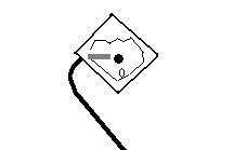
| Roundabout in Road T. Junction N32° 13’ 40" E34° 49' 50" | 00:00 | |||
CP1 |
| Structure TT 060° / 6.1 NM from SP | 04:39 | |||
CP2 | Bridge TT 020° / 9.5 NM from SP | 09:37 (= 4:39+4:58) | ||||
CP3 | Railway station 5.3 NM from CP2 6.0 NM from CP4 | 13:56 (=9:37+4:19) | ||||
CP4 | Road T. Junction N32° 17’ 02" E34° 59' 14" | 18:44 (=13:56+4:48) | ||||
FP |
| Dirt Road crossing TT 206° / 6.5 NM from CP4 | 23:55 (=18:44+5:11) After FP contact SDV 124.00 | |||
Landing Airfield | LLSD | From FPclimb to BAZRA 1100' for regular approach | After parking - take GPS monitor + result table to judge station | |||
From the archive · DocumentBefore 10/10/2013
Task sheet
Original file: Task_sheet.doc (DOC · 798 KB)

 MPORTANT REMARKS